

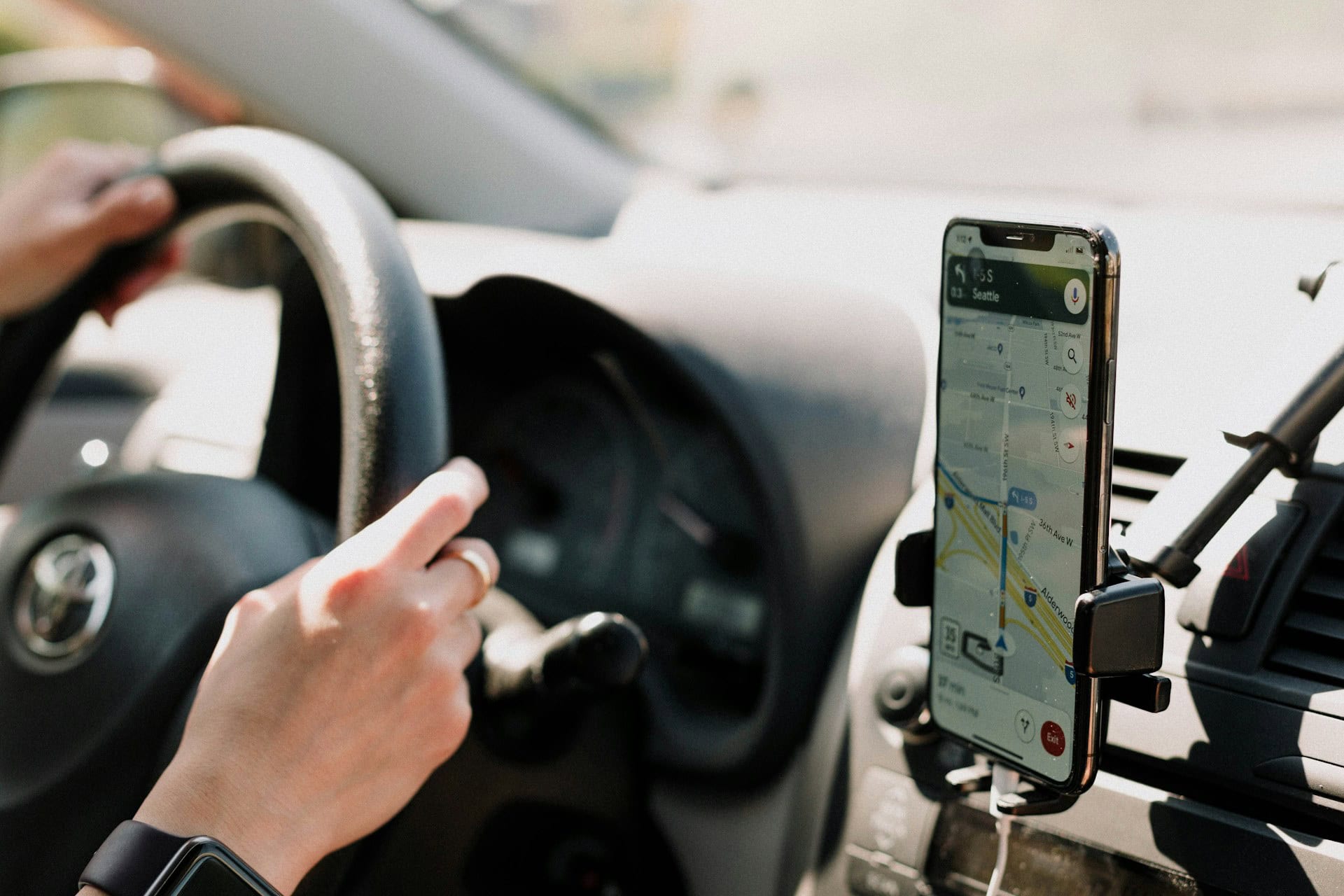
Google Maps is one of the most popular Google applications, used by millions of people every day in Android and iOS apps and in Internet browsers. It allows you to view detailed maps of cities, search for places, and create routes, which is very convenient both in everyday life and when planning long trips.
But that's not the end of the program's capabilities, although few people know what other features and functions it has. Moreover, if you know a few tricks, you can make working with Google Maps much easier. So, what can this tool do and how can it help you explore the world?
7 features to get the most out of Google Maps
The tool allows you to plan routes by various means of transportation and on foot, virtually "walk" the streets, and find various places: from restaurants to shops and gas stations. To get the most out of Google Maps, and not just use its most obvious features, you should know about a few other options.
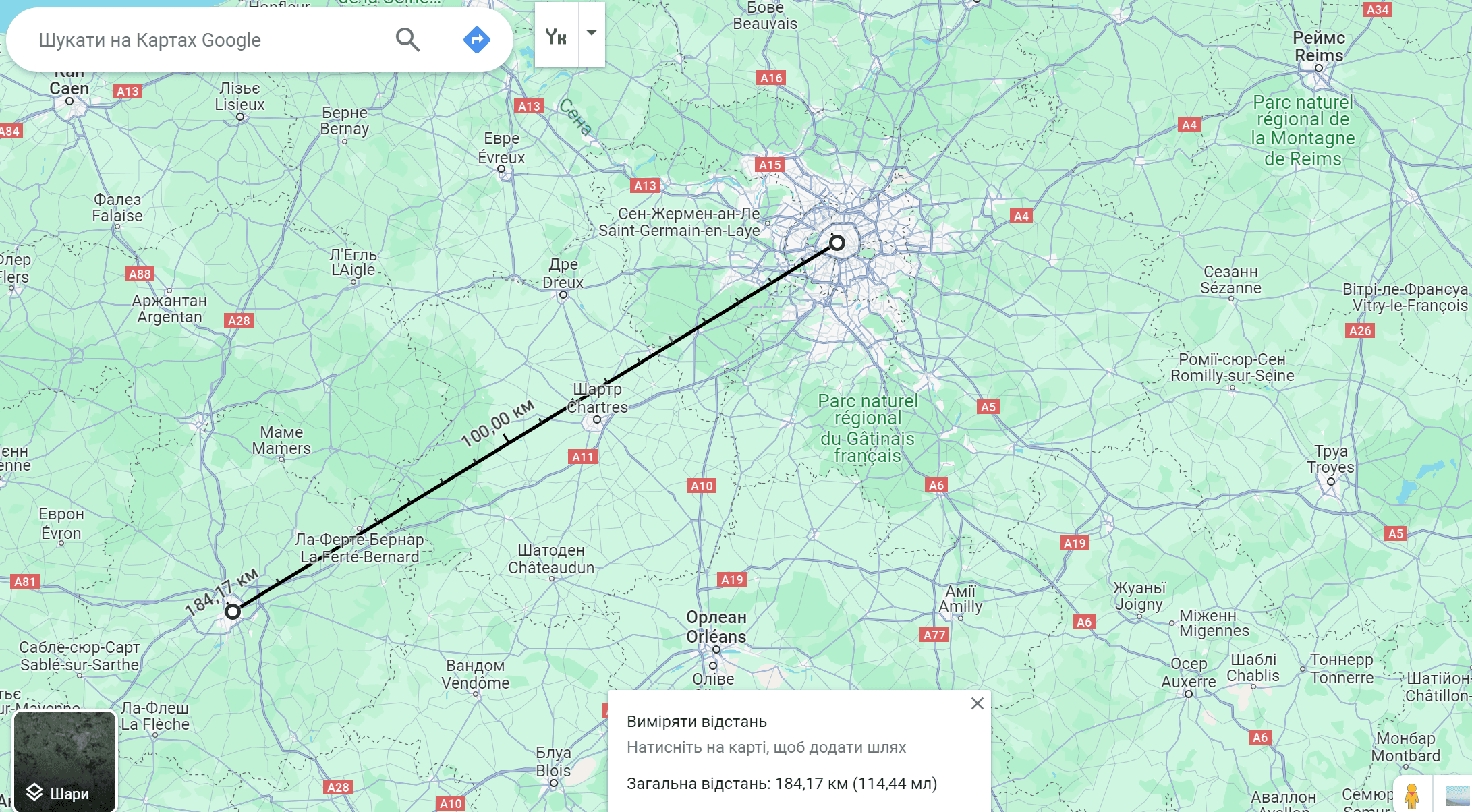
Measuring straight lines and areas
It is well known that Google Maps can easily determine the distance between two places and show you the way to go by car or on foot. But what if you need the direct distance between points on the map? This can be useful, for example, when planning hiking routes or measuring the size of a property.
To measure a straight line distance:
- open Google Maps on the Internet;
- right-click on the spot and select "Measure distance",
- click elsewhere to get the distance.
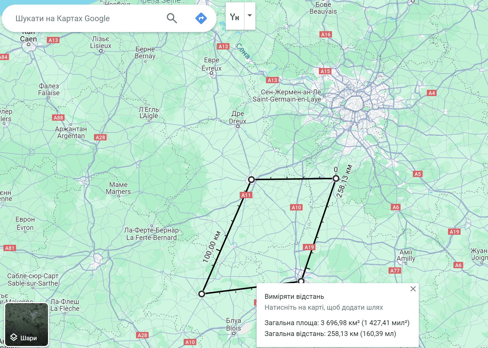
To measure the area, keep clicking to add more nodes and connect the last one with the initial one. As a result, the service will show the total distance and the total area.
Zoom with a double tap
Despite the fact that this trick has been around for quite some time, many users have not yet discovered it. If you're using the app on Android or iOS, you can double-click and hold your finger or thumb on the map, then drag up or down to zoom in and out.
This means that you can zoom the map with one hand while the other is busy - perhaps you're holding a handrail, walking the dog, or carrying groceries.
Find bicycle and dirt paths
If you need to figure out which road your walking route is, or if you're going to ride a bike, Google Maps has a tip that works on all platforms. It is the "Bike" layer. You can find it in the lower left corner of the screen.
After selecting the appropriate function, the map will change the way routes for cyclists are marked: different types of lines for trails, dedicated bike paths, cycling-friendly roads, and dirt trails will appear. Unfortunately, the feature is not yet available for Ukraine, but it will be a great help for orientation, for example, in European countries.
Adding your own locations
The places you need that do not have a significant public value may not always be marked on Google Maps. We're talking, for example, about a picnic or parking lot, a park bench, or a friend's house. If they are not on the map, you may have difficulty finding them or navigating.
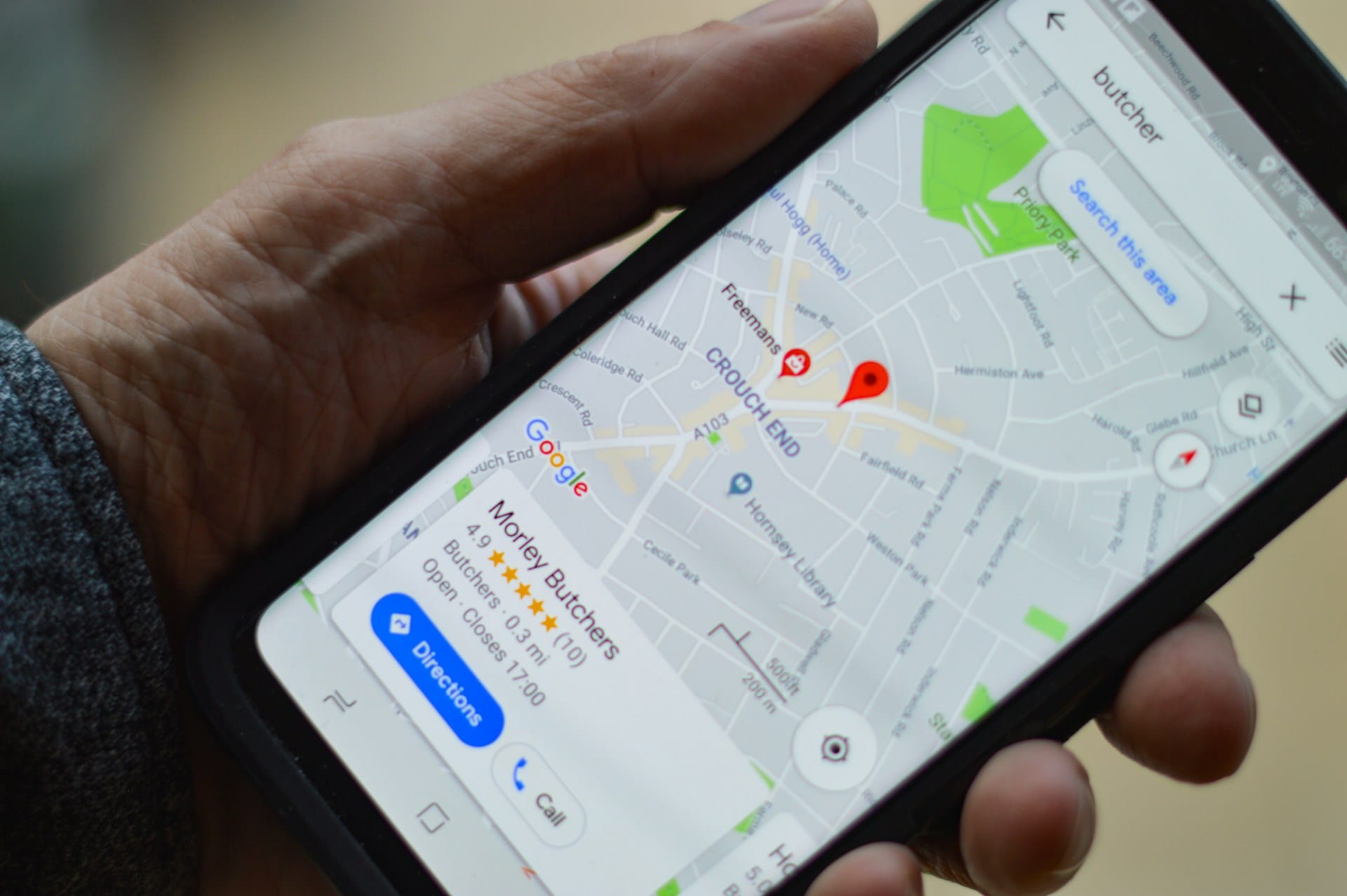
You can fix this by creating your own location:
- tap and hold the place in the mobile application where you want to mark;
- pull out the information card and select Add label.
The newly created tags will appear in the search results as flags on the map and in your saved locations.
Reminder of the parking lot
No more wasting time looking for your car when you visit shopping centers or amusement parks with large parking lots. Google Maps will remember your car's parking spot for you.
Have Google Maps remind you of the parking lot:
- when you are parked, click on the blue dot on the map in the mobile application;
- select "Save parking" in the panel that appears.
When it's time to go back, just search for "Parking" in the app to see the mark you created. Alternatively, smoothly move the map image in different directions, creating a panoramic effect, to find the "You parked here" flag - tap it and get directions to the right place.
Reporting an accident on the road
Every Google Maps user can help others by reporting accidents you see while traveling. To warn about an accident:
- in the navigation mode of the mobile application, tap the icon on the right (the "plus" symbol inside the search box);
- among the options, which will differ depending on the country, select "Accident". Roadworks, traffic jams, etc. may also appear in the list. If Google Maps receives enough of these individual notifications, a warning for each of them will appear on the map.
Answers to questions about locations
Each user has the opportunity to contribute to the social and community aspects of Google Maps by providing useful information about certain objects. For example, the opening hours of an establishment, whether it has a parking lot, whether the entrance is accessible, etc. One day, you may be grateful that someone else helped you with your own travels in this way.
To provide information about a specific location, follow these steps:
- open the Add tab;
- add a place you have visited and would like to share information about;
- create a review and answer a few questions that the program will ask you;
- you can add a photo.
Seemingly familiar services that have been studied inside and out almost always have at least a few features that are invisible to the naked eye. It's worth knowing about them to maximize the productivity of your apps. In the case of Google Maps, such knowledge opens up opportunities to explore the world.